Every Biker, Traveler in India dreams of visiting Spiti and Ladakh at least once in a lifetime. It has become a haven for those people over time. In older times, we can look at travelogue by writers like Rahul Sanskrityayan about the route. So the course is a familiar one. There was a generation who travelled this route on foot. In this article let’s take a look at the water crossings in Spiti valley and Ladakh.
With some of the highest motorable roads in the world, the Ladakh valley and Spiti valley are visited by thousands of thrill-seeking travel enthusiasts. Check out my articles on how to read Ladakh & Spiti valley.
The ambience and aura of the valley are unique, and the water crossings make it more memorable. These water crossings in Spiti valley & Ladakh makes the travel worth remembering.
Ladakh Valley and Spiti valley are bordering areas near China. Due to the terrain, construction in the region is complex. Border Roads organization is responsible for the maintenance and structure of the roads in these areas. Check out the condition of roads in Spiti valley.
Some streets in Spiti are hard to travel on; the water crossings in Spiti valley make them more challenging.
Amidst all the bliss ushered by the BRO by making these super highways, we must enjoy these water crossings. Here is a list of the water crossings I crossed and those I know.
What exactly is a water crossing?
The water crossing is where the pucca/concrete/stone/damar road gets submerged under the massive water flow. This water comes as a result of melting snow.
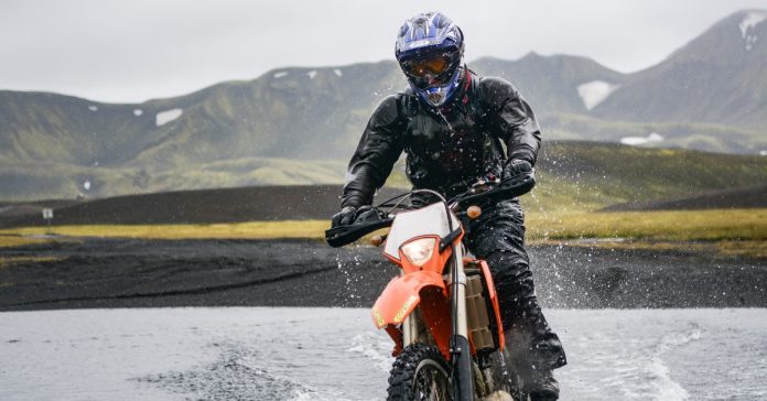
The continuous flow of the water leaves potholes and boulders. Crossing these is an essential task to proceed on the way. Riding them is even more complicated if you’re visiting on a bike. It requires expertise to manoeuvre a motorcycle on the turbulent water flow. A few of them remain closed due to heavy snowfall in winter.
The above water crossing is on the way to Ladakh, Baralacha Paas.
The one below is my friend when he was crossing Sarchu going to Ladakh.
Water crossings in leh ladakh
First, let us check out the major water crossings in Leh Ladakh region.
Water crossings in Leh Ladakh – Zoji La Pass

One of the highest passes in the Srinagar- Leh Highway, The Zoji La, connects Srinagar to Drass valley. This is the first water crossings in Leh Ladakh coming via the Pathankot route.
It is at an elevation of 3528 m above sea level and is close in the winter. With the start of hot summers, the snow melts, and the water comes onto the roads. The road is almost asphalted, but the top of the pass is terrible.
The massive truck carrying essentials further deteriorates the road. Till April and May, one encounters heavy snow at the top. This is dominated by melting water from nearby peaks in July and August.
Water crossings in Leh Ladakh – Sarchu and Zing Zing Bar
Check out my vlog for this water crossings in Leh Ladakh. This is just after Sarchu and Zing Zing bar.
Most visitors to Leh stopped at Sarchu, a settlement halfway between Manali and Leh. The Lungalacha Pass marks a difference in the route’s condition from Leh to Pang, which is in good condition otherwise.
A few river crossings between Sarchu and Baralacha La call for caution. Similar to this, there are a couple of additional river crossings between Baralacha La and Zing Zing Bar. Although I saw the road’s construction in full swing during my visit, I doubt it will withstand the region’s severe weather.
Take a look at a few more of the Ladakh water crossings from my friend Taranjeet who keeps on riding in the valley. Check out his Instagram.
Water crossings in Leh Ladakh – Pangong Tso and Tso Moriri

The route connecting Pangong Tso and Tso Moriri is one of the most challenging in India. Anyone who has travelled this distance knows how tough it can be. This is by far one of the worst Ladakh water crossings.
The rise in water level is caused by snow melting from neighbouring peaks. Still, the obstacle between Pangong Tso and Tso Moriri is caused by the overflowed Indus River.
There are a few water crossings on the path from Pangong Tso to the Chushul Village, but for the most part, it is picturesque ( thanks to a ride parallel to the Pangong Lake). Between Mood Village and Nyoma Village, where the Indus River runs parallel to the road, is where the main difficulty lies. It was monsoon season in India when I travelled to Leh-Ladakh in August.
Most rivers run over their danger threshold during that time of year, and the Indus River was no exception. The Indus River had overflowed its banks at Loma Bend, covering the whole route, and there was no indication of the road elsewhere. I debated whether to continue or turn around and head back to Pangong Lake for 40 minutes.
Water crossings in Leh Ladakh – Tangtse Village to Spangmik Village

This route is well known to everyone who has visited the Pangong Tso. The bulk of the way from Leh City to Pangong Lake is in decent shape (apart from Chang La), but as Pangong Lake gets closer, the state of the road deteriorates.
I recall travelling through ten to fifteen little and large water crossings when visiting Ladakh, especially while seeing Pangong Tso. The minor water crossings were simple to navigate, but the larger ones caused considerable congestion. I attempted to cross a body of water by speeding my motorcycle but was soaked in the icy water. There are several other crossings between Spangmik and Phobrang villages.
Major Water Crossings in Spiti Valley

The Spiti Valley is referred to as a biker’s paradise, just like the Ladakh Valley is. There are two ways to go to the Spiti Valley, like Leh-Ladakh.
The Rohtang Pass and Kunzum Pass are used on the first route, and Shimla-Reckong Peo-Nako is operated on the second route.
Even though both roads go to the Spiti Valley, they are both known for treacherous water crossings. On their way to Spiti Valley, riders must cross the following list of waterways.
Between Gramphu and Chhatru, a water crossing
As a tri-point between Leh, Spiti, and Manali, it serves the Gramphu Village. There are 4-5 water crossings between Gramphu and Chhatru, which presents a challenge. The road on this route is lousy and goes parallel to the Chenab River.
While riding to Spiti Valley, I encountered five river crossings in the 18 km stretch between Gramphu and Chhatru. The route at this portion is made up of sand, dirt, and rock boulders, making it more challenging to cross the river.
Please note that the mobile network does not work between Gramphu and Kunzum La. This is a stretch of 80 Km.
Water Crossing At Chota Dara
This river crossing was the most hazardous in the entire Spiti and Ladakh Valley journey. The most significant river crossings all begin in Chota Dara. However, Chota Dara is where the Gramphu-Batal-Kaza road is in the worst condition.
Furthermore, a sea of water is brought by the quickly melting snow from the adjacent peaks, which makes it much more challenging to traverse. The Chota Dara river crossing was where our bikes and energy were most severely damaged throughout my journey.
Water Crossing at Malling in Spiti Valley
On the Nako-Kaza road lies a little settlement called Malling. The perilous Malling Nalah crossing is the village’s most prominent feature. Although the road in this section is superior to the Batal-Kaza-Route, crossing Malling Nalah demands good manoeuvrability, particularly during the winter.
The Malling Village is 3600 meters above sea level, forcing the water to stay frozen for most of the year. Snow melts throughout the summer months, yet landslides are still a problem. Those who have travelled this section of the Rampur-Nako-Kaza route know it is the most hazardous.
Water Crossing at Spello
The Shimla-Kaza route is one of the best highways constructed by the Border Roads Organization in the Himalayan area. Most of it is in great shape. However, the section in and around Spello presents severe difficulties for cyclists.
Landslides frequently occur in the area, and as I cycled to the Spiti Valley, I was detained at Spello for six hours. A landslide and mudslide recently blocked the route, and it took six hours for authorities to clear the way.
The Shimla-Kaza route has a few shorter stretches. Still, they don’t provide a significant barrier compared to the other water crossings described above.
Precautions to Take While riding through Water Crossing
The primary water source for every water crossing en route to Ladakh or the Spiti is melting the snow. Both the temperature and the rate of water flow rise during the day. So it’s best to cross these waterways as early as possible in the day.
There is a good chance that these river crossings will be flooded if you wait and try to travel in the afternoon. However, the same regulation does not apply to snow and black ice hubs, even if I witnessed a few vehicles in similar circumstances.
The Chota Dara wrecked two motorbikes during my journey on the Batal-Kaza Route, forcing us to forego our excursion to the Spiti Valley. Nearly all of India’s hill roads include water crossings, which I experienced when travelling across North-East India. However, compared to other areas of India, water crossing in the Himalayan region is far more hazardous and difficult.
Everyone considering visiting Ladakh or the Spiti Valley will gain some understanding from this essay. Because it significantly affects my memory, I will concentrate on one specific water crossing in the forthcoming post, namely the Chota Dara Water Crossing.
Any questions related to the article please drop a comment below.


